
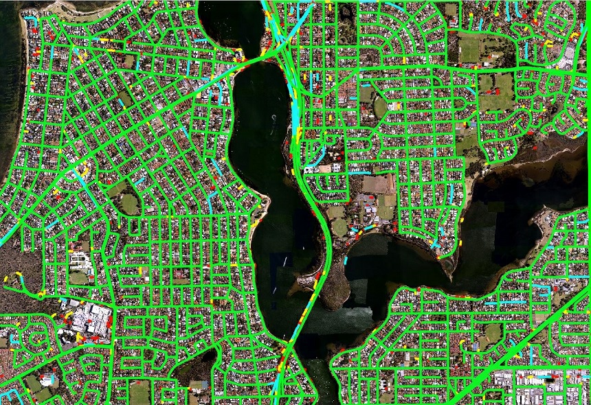
Road networks used for asset management need both geometry and condition: surface, furniture, and safety features, refreshed from imagery rather than left to age in a GIS layer.
Existing road-network data often lacks the detail and currency needed for asset monitoring and smart transport. Mapizy’s road work uses transfer and deep-learning models to detect road furniture and safety features in both 10 cm aerial imagery and satellite imagery of similar quality, and packages GIS-ready road surface and safety-feature data with regular updates.
Key takeaways
Aerial and satellite
Models are described as working across 10 cm aerial imagery and comparable satellite imagery so coverage is not limited to one sensor.
Surface and safety
Packaged road data represents road surface and safety features, not only centreline geometry.
Mobile mapping
Computer-vision solutions have been used to assess road-surface condition in mobile-mapping images.
Vegetation risk
Related infrastructure work includes vegetation encroachment to power lines, a reminder that corridor assets sit in a living landscape.
Methodology
Collect imagery
Use aerial, satellite, or mobile-mapping imagery depending on the asset question: network extent, furniture, or surface condition.
Detect assets
Apply models that locate road furniture and safety features, then keep the network current with regular updates.
Serve GIS teams
Deliver GIS-ready layers through packaged data and Mapizy Studio so monitoring is an operational layer, not a one-off project.
Practical applications
Transport and local-government teams can use a current road layer for asset registers, safety-feature audits, and network completeness. Mapizy’s infrastructure solutions also cover surface-condition assessment and safety-feature measurement. Packaged road network data is intended as a digital representation freshly derived from aerial images.
This report uses only claims already published on Mapizy’s use-case, solutions, and packaged-data pages. It does not invent completeness percentages. Occlusion, shadow, and image resolution still limit what furniture can be seen. Diagrams are conceptual.
Related reports
Inspect road network data
Request a demo to review GIS-ready road surface and safety-feature layers.
Request a demo